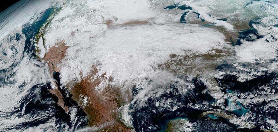
The National Oceanic and Atmospheric Administration has released the first images of Earth taken by the Advanced Baseline Imager (ABI) on the agency’s Geostationary Environmental Satellite-16 (GOES-16) on Monday.
The new pictures of our planet show it in detail at the highest resolutions to date, and they will be even clearer once the satellite is fully operational according to the government body.
The NOAA, working under the U.S. Department of Commerce, is one of the country’s entities in charge of dealing with environmental issues. Recent reports show sister agencies like the EPA and the USDA might be silenced or censored under the new administration.
GOES-16 will provide High-Res photos of Earth
Thanks to its next-generation instruments, the GOES-16 satellite will be able to image the Earth and its climate at an unprecedented quality, keeping track of weather phenomena and relaying data with more accuracy.
Launched on November 16 last year from Cape Canaveral, Florida, the GOES-16 carries perhaps its most important payload on the ABI developed by Harris Corporation.
The optical instrument can observe and take pictures of our planet from 16 different spectral bands at distances as short as 0.5 km. The updated ‘Blue Marble’ photo snapped by the satellite is four times more detailed than the highest-resolution pictures.
On top of that, the GOES-16’s ABI was developed with weather tracking in mind, so it can follow climate events at intervals of 30 to 60 seconds in contrast to old satellites that take photos every 15 minutes or so.
The geostationary spacecraft was enhanced to detect and record not only impactful phenomena such as hurricanes and typhoons, but also more specific things like volcanic ash, fires, and dust storms.
The latest NOAA satellites will be able to send information to ground stations back on Earth faster than their predecessors and generate reliable forecasts up to 10 days in advance.
GOES-16 is the first of four NOAA weather satellites
GOES-16, previously known as GOES-R, is the first of four planned weather satellites in orbit carrying the latest monitoring technology by Harris Environmental Solutions.
The NOAA will announce in May the definite location of GOES-16, where it will operate at its fullest capacity as either GOES-East or GOES-West.
The three remaining satellites are still under development under the public-private partnership between the firm and the Administration. Once in orbit, they will, presumably, cover South, North, and the opposite location of GOES-16.
GOES-S, the next unit of the constellation, is undergoing tests in Littleton, Colorado. NOAA has scheduled its launch for Spring 2018.
The satellite will then turn into GOES-17 while it awaits positioning instructions. Harris has a deal with the NOAA through 2035 to develop the rest of the spacecraft for an estimated $11 billion.
Source: NOAA / Press Release


